
Review · SPAIN
La Palma: Guided trekking tour to volcanoes south
La Palma’s Volcanoes Route gives you a full day of raw volcanic scenery, from pine woods at El Pilar to the red cone of Volcán de Martín near Fuencaliente. I like the sharp contrast between green forest and black, brown, and red ash. I also like the wide views toward the Caldera de Taburiente and nearby islands when the air is clear. The catch is simple: 17 kilometres of hiking with a climb near the start and a demanding descent later, so this is not a casual stroll.
I especially like that the tour includes hotel pickup and return transport, which removes the awkward problem of arranging a one-way mountain walk. The guide adds useful context about La Palma’s eruptions, and Arnie has earned particular praise for both guiding and transport. Still, bring your own food and drinks, and take the fitness warning seriously.
Key points before you book
- 17 km from El Pilar to Los Canarios: This is a point-to-point mountain hike, not a short volcano visit.
- Nearly 2,000 metres above sea level: The highest section brings broad views and the chance of walking through cloud.
- Hoyo Negro begins the crater section: From here, the route becomes a long procession of volcanic cones and ash.
- Volcán de Martín marks the final volcanic drama: Its reddish cone is one of the most memorable sights near the end.
- Transport is included: Hotel pickup, drop-off, and the return transfer from Los Canarios are part of the experience.
- A tough but well-supported day: Spanish, English, and German guiding are available, with small-group options.
Why the Volcanoes Route is La Palma’s signature hike
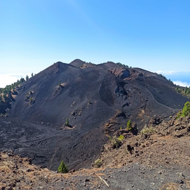
This route crosses the southern mountain spine of La Palma, inside the Cumbre Vieja Natural Park. It is one of the clearest ways to see how the island was built: not through one single volcano, but through a chain of craters, ridges, lava fields, and ash-covered slopes.
The route covers about 17 kilometres between the Refugio de El Pilar and Los Canarios in Fuencaliente. You begin in a setting that still feels like the Canary Islands people picture: tall Canary Island pines, cool mountain air, and dark soil beneath the trees.
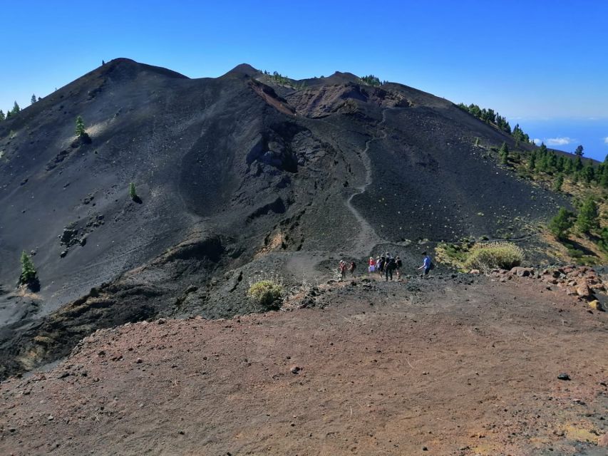
As you continue south, the trees thin out and the ground becomes more exposed. The green of the pines gives way to volcanic shades of charcoal, rust, brown, and deep red. The effect is striking without needing much decoration. At times, the route really does look more like a walk on Mars than a hike on a Spanish island.
The scenery keeps changing, which matters on a long day. You are not staring at one crater for hours. You move between forest, ridges, ash, cones, and open viewpoints, with the Atlantic and both sides of the island appearing when the weather allows.
More Volcano Treks in Spain:
- La Palma: Tajogaite Volcano Guided Trek
★ 4.8 · 1,810 reviews - Volcano Trekking Tour (Timanfaya eruptions)
★ 5.0 · 339 reviews - Trekking in the Volcanoes Natural Park in a small group
★ 5.0 · 97 reviews
Starting at El Pilar and climbing toward Pico Birigoyo
The hike begins at the El Pilar Refuge on the GR-131 trail. The first part is uphill, and that early climb sets the tone for the day. You will skirt Pico Birigoyo and gain height before the route opens to larger views.
From this section, you may see the Aridane Valley, the Caldera de Taburiente, and Roque de Los Muchachos in the distance. Roque de Los Muchachos is La Palma’s highest point, so the view gives you a useful sense of the island’s steep interior.
The route also looks toward El Paso, Los Llanos de Aridane, and Tazacorte. These views are valuable because they show how quickly La Palma changes from high volcanic ridges to settled valleys and the coast.
The uphill start is also the first practical test. You need enough energy for more than the opening climb, since the day continues through several high sections before the final descent. If you normally walk only on flat paths, this route may feel harder than the distance suggests.
Your guide can help put the setting into context as you walk. The tour focuses on the island’s volcanic activity, so the changing rock and ash are not just scenery. They become clues to the sequence of eruptions that shaped this young part of La Palma.
Hoyo Negro and the first major crater views
The path continues through Canary Island pine forest before reaching Hoyo Negro. This crater marks the beginning of the route’s most memorable volcanic section.
Hoyo Negro is a good point to pause and take in the shift from wooded mountain trail to open volcanic ground. Depending on the weather, you may see Santa Cruz de La Palma, Los Cancajos, and other parts of the island. On clear days, Tenerife, La Gomera, and El Hierro can appear offshore.
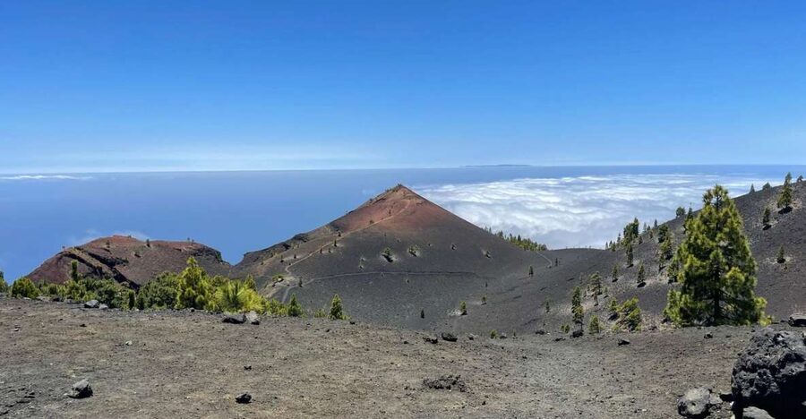
Weather controls much of this view. Cloud can hide the distant islands and valley towns, but it can also create one of the route’s unusual sights: a white blanket below the trail. Walking above or through cloud gives the high ridge a completely different mood from the sunny volcanic slopes farther south.
Do not treat the cloud as a disappointment. It may block the long-distance views, but the close-up details of ash, rock, and pine become stronger in misty conditions. The trade-off is that you cannot count on seeing all four islands or both sides of La Palma on every departure.
Las Deseadas, the high point, and the long descent
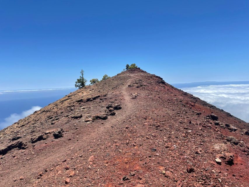
After Hoyo Negro, the route continues among more craters and volcanic ridges. Las Deseadas is the highest point of the route, close to 2,000 metres above sea level.
This high section gives you the broadest sense of La Palma’s central spine. You can look across the island and, when the air is clear, out toward the other Canary Islands. The exposed setting also brings stronger weather changes, so layers are sensible even if conditions at your hotel feel warm.
Reaching the high point does not mean the hard work is over. The route then begins its descent toward Fuencaliente, and the descent is specifically described as difficult. Descending on volcanic ground can be tiring in a different way from climbing, especially after several hours on foot.
I would plan your pace conservatively. There is little value in rushing the first half and reaching the southern craters worn out. The route is scenic from beginning to end, so save enough energy to enjoy the final cones instead of viewing them only as obstacles between you and the bus.
A few more treks around Spain worth a look
- Caminito del Rey: Trekking Tour with Hiking Guide
★ 4.1 · 295 reviews - Gran Canaria: Guided Via Ferrata Excursion
★ 4.9 · 198 reviews - Fuerteventura: Guided Trekking Tour with Island Goats
★ 4.9 · 146 reviews - La Palma: Guided Trekking Tour to El Roque de los Muchachos
★ 4.6 · 104 reviews
Volcán de Martín and the approach to Los Canarios
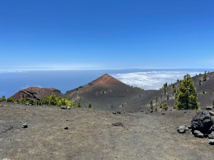
Volcán de Martín is one of the last major craters along the route. Its reddish cone catches the eye from a distance and gives the final section a strong visual finish.
The color is part of its appeal. After the darker ash and green pine forest earlier in the day, the red volcanic cone feels like a change in the palette. It is also a good place for photographs because the form of the crater is easy to read from the surrounding path.
From there, you descend toward Los Canarios in Fuencaliente, the southern end of the hike. A transfer waits there to take you back to the starting area. This return arrangement is important because the walk is point to point. Without it, you would need to solve your own transport from the south back to your accommodation.
The final descent can be physically demanding, so do not judge the tour only by its total distance. The combination of early climbing, high ridges, uneven volcanic ground, and a long downhill finish is what makes this an ambitious day.
What the guide adds to a volcanic walk
A guide is useful here because the route has more to offer than photographs. Without some explanation, one crater can start to look much like another. The guide connects the ash, lava, calderas, cones, and forest to La Palma’s volcanic development.
The tour is available with a live guide in Spanish, English, or German. Small-group availability is also offered, which can make it easier to keep the walking pace manageable and ask questions along the way.
Arnie is a guide name attached to particularly strong feedback about the experience. The praise focuses on both the quality of the guiding and the transport arrangements. That pairing matters on a full-day hike. You want the walking information to be useful, but you also want the logistics before and after the trail to work without fuss.
The guidance does not remove the physical challenge. A good explanation of volcanism cannot make 17 kilometres feel shorter. It can make the route more meaningful and help you notice details you might otherwise pass by.
What to pack for eight hours on the trail
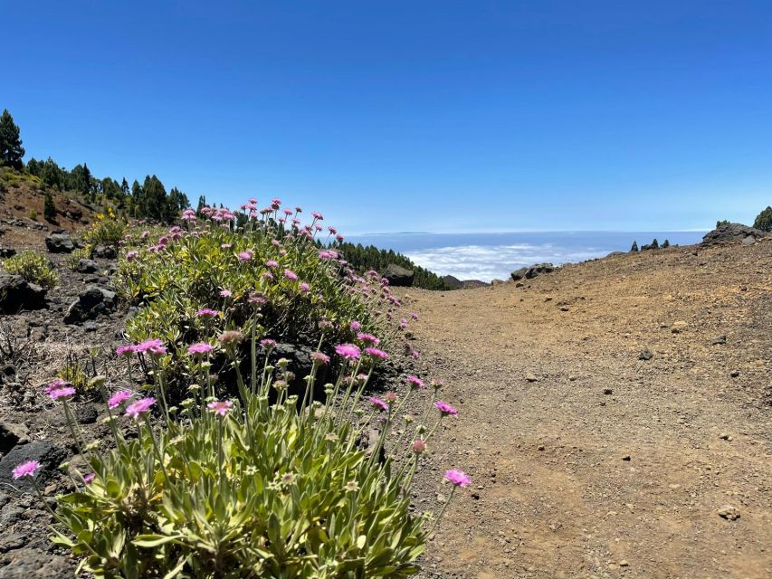
Food and drinks are not included, so you need to bring your own supplies. This is one of the most important practical points in the booking decision. An eight-hour outing with a long climb and descent is not the time to depend on finding a shop along the trail.
You should also think about clothing for several mountain conditions. The route reaches almost 2,000 metres, and the description allows for cloud on the high sections. Warm conditions at sea level do not tell you what the ridge will feel like.
Useful preparation includes:
- Enough food and water for the full outing
- Footwear suitable for a demanding mountain trail
- Clothing that can handle sun, wind, and cloud
- A camera or phone for the changing volcanic colors
- Enough energy to manage the descent as well as the climb
The photography is a genuine reason to choose this trip. Black ash, red cones, green pine, white cloud, and distant ocean views can all appear on the same route. Keep your camera easy to reach, but do not let photos distract you from watching your footing on the rougher sections.
How much value does the $50 price offer?
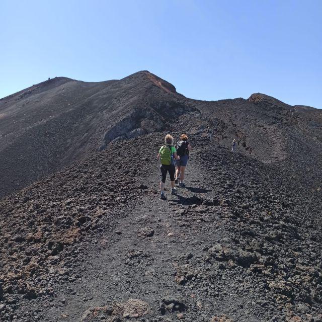
At $50 per person, the value rests mainly in what is included around the hike. You get hotel pickup and drop-off, a live guide, and a return transfer from Los Canarios after completing a one-way route.
That transport is not a minor extra. The trail starts at El Pilar and finishes in Fuencaliente, so the tour solves the practical issue of moving you between two distant points. A guided route also saves you from tackling the volcanic history alone and gives structure to a long day in the mountains.
The price does not cover food or drinks, so budget for those separately. It also does not turn the hike into an easy sightseeing outing. You are paying for support and interpretation around a serious walk, not for a vehicle-based volcano tour.
For someone already planning to hike the full route, $50 is a sensible price for the transport and guide. For someone uncertain about long mountain walks, it may be poor value if the distance or descent proves too much. Your fitness is the deciding factor.
Who should book this hike?
I would recommend this experience to you if you enjoy long mountain walks and want to understand La Palma through its volcanic terrain. It suits people who like changing scenery, open ridges, crater views, and a full day outdoors rather than a quick stop at one viewpoint.
It is also a good choice if you are staying on La Palma without a practical way to organize a one-way hike. Hotel pickup and the return transfer remove much of the planning burden.
You should think twice if you are not in good physical condition. The route is explicitly described as tough, and the total distance is 17 kilometres. The descent after Las Deseadas is not a gentle stroll, even though you are heading downhill.
The experience may also be less suitable if your main goal is guaranteed views of Tenerife, La Gomera, and El Hierro. Those sightings depend on clear weather. The volcanic craters and colors remain the main attraction when cloud blocks the horizon.
Booking, timing, and cancellation details
The tour lasts about eight hours, with starting times depending on availability. The meeting point can vary according to the option you book, so check the exact pickup details before setting out.
You can cancel up to 24 hours in advance for a full refund. A reserve-now, pay-later option is also available, which gives you some flexibility while you arrange the rest of your La Palma plans.
The group may be small, but small-group availability is an option rather than a promise for every booking. The guide languages are Spanish, English, and German.
Should you book the Volcanoes Route?
Book it if you want La Palma’s strongest volcanic day and you are ready for a real 17-kilometre hike. The mix of pine forest, ash, crater rims, red cones, high mountain views, and possible cloud cover gives the route far more variety than a short volcano viewpoint.
The best reasons to book are the point-to-point transport, the guide’s explanation of the island’s eruptions, and the chance to walk through the Cumbre Vieja volcanic zone rather than simply look at it from a road.
Skip it if you want a relaxed excursion, dislike long descents, or are counting on perfect distant-island views. For fit walkers who bring food, dress for mountain weather, and pace themselves, this is one of the most rewarding ways to see southern La Palma.
FAQ
How long is the Volcanoes Route hike?
The route is about 17 kilometres long, running from the El Pilar Refuge to Los Canarios in Fuencaliente.
How long does the activity last?
The full activity lasts eight hours, including the guided hike and transport arrangements.
How high does the route reach?
The route reaches almost 2,000 metres above sea level, with Las Deseadas identified as its highest point.
Is hotel transportation included?
Yes. Hotel pickup and drop-off are included, along with a transfer back from Los Canarios to the starting area.
Which languages are available for the guide?
The live guide is available in Spanish, English, and German.
Are food and drinks included?
No. Food and drinks are not included, so you need to bring your own supplies.
Can I cancel for a full refund?
Yes. You can cancel up to 24 hours in advance for a full refund.
Just added around Spain
- Via Ferrata John Hogbin with Photos★ 5.0 · 4 reviews
- Half-Day Adventure and Climbing Via Ferrata in Gran Canaria★ 5.0 · 25 reviews
- The Roque Nublo Base Camp Experience: Hiking, Picnic and Climbing★ 5.0 · 11 reviews
- Private Climbing Experience Via ferrata Senda do Santo★ 5.0 · 8 reviews
- Via Ferrata Cala del Molí★ 4.0 · 4 reviews
- Via ferrata Cala del Molí in Sant Feliu de Guíxols★ 5.0 · 2 reviews
- Via ferrata de Sant feliu de guíxols – Via ferrata cala del molí★ 5.0 · 47 reviews
- Via Ferrata Adventure in Madrid with Transport★ 5.0 · 4 reviews
Volcano Treks, compared.
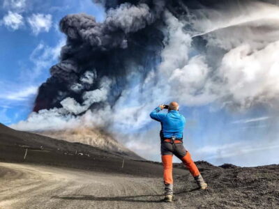
Mount Etna: Trek to 3000m with cable car and 4×4
Read our review →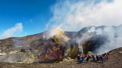
Mount Etna: Summit Crater Trek with Cable Car
Read our review →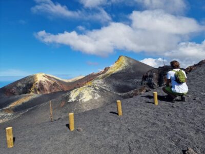
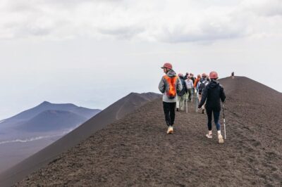
Etna: summit craters trekking with volcano guide 3350mt
Read our review →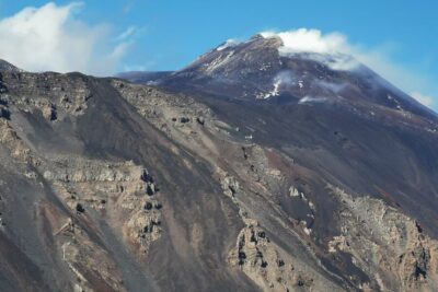
Mount Etna Trekking Tour Beyond the Tourist Trails
Read our review →
Mount Etna: Guided Trek 3,000 Meters to the Summit
Read our review →
Etna Sunset Tour: Volcano trek, Cave & tasting from Catania
Read our review →
Browse the lists this trek appears in